Our drones leverage CAA regulations to operate in densely populated urban areas without restrictions. This removes the need for costly risk assessments and CAA authorisations, which are never guaranteed, along with bureaucratic delays, reducing both time and costs. With a ground sampling distance (GSD) of less than 1cm/px and centimetre-level global/absolute accuracy, we deliver fast, precise results, enabling construction projects to progress more efficiently and at lower costs. Please not that though we can operate freely in populated urban areas, there are some hard and fast restrictions such as Airports etc. which would require CAA authorisation.
3D Models
We create georeferenced, detailed 3D models of buildings and landscapes to 1cm relative accuracy and 1 – 2cm global accuracy depending on requirements. These models are used for construction planning, visualizing project progress, assessing structural features, and aiding urban design. They are also valuable for renovation planning, heritage preservation, and integrating models into BIM (Building Information Modelling) workflows for accurate project coordination.
The lodge by chapperz.dj on Sketchfab
DEM (Digital Elevation Model)
We produce georeferenced DEMs with 2cm/px GSD accuracy to model terrain features, support flood risk assessments, and plan infrastructure projects. DEMs are essential for understanding elevation changes, optimizing drainage solutions, and assessing terrain for accessibility or potential hazards.

Orthophotos
Our high-resolution, georeferenced orthophotos are captured at 2cm/px GSD and are used for mapping, site analysis, and inspection tasks. These images are critical for measuring distances, planning layouts, and monitoring progress in construction projects. Orthophotos also support environmental studies, asset management, and compliance with planning regulations.
Point Clouds
We provide georeferenced, dense 3D point clouds ideal for generating 3D models, extracting dimensions, and creating as-built documentation. Point clouds support design planning, clash detection, and detailed surface analysis. They’re often used to reconstruct structural features, monitor changes over time, and provide a foundation for CAD and GIS workflows.
DTM (Digital Terrain Model)
Our georeferenced DTMs provide accurate representations of bare-earth surfaces, excluding vegetation and buildings, with 2cm/px GSD precision. They are widely used for grading, land surveying, erosion studies, and infrastructure planning. DTMs also help in designing roads, pipelines, and other construction projects requiring precise terrain information.
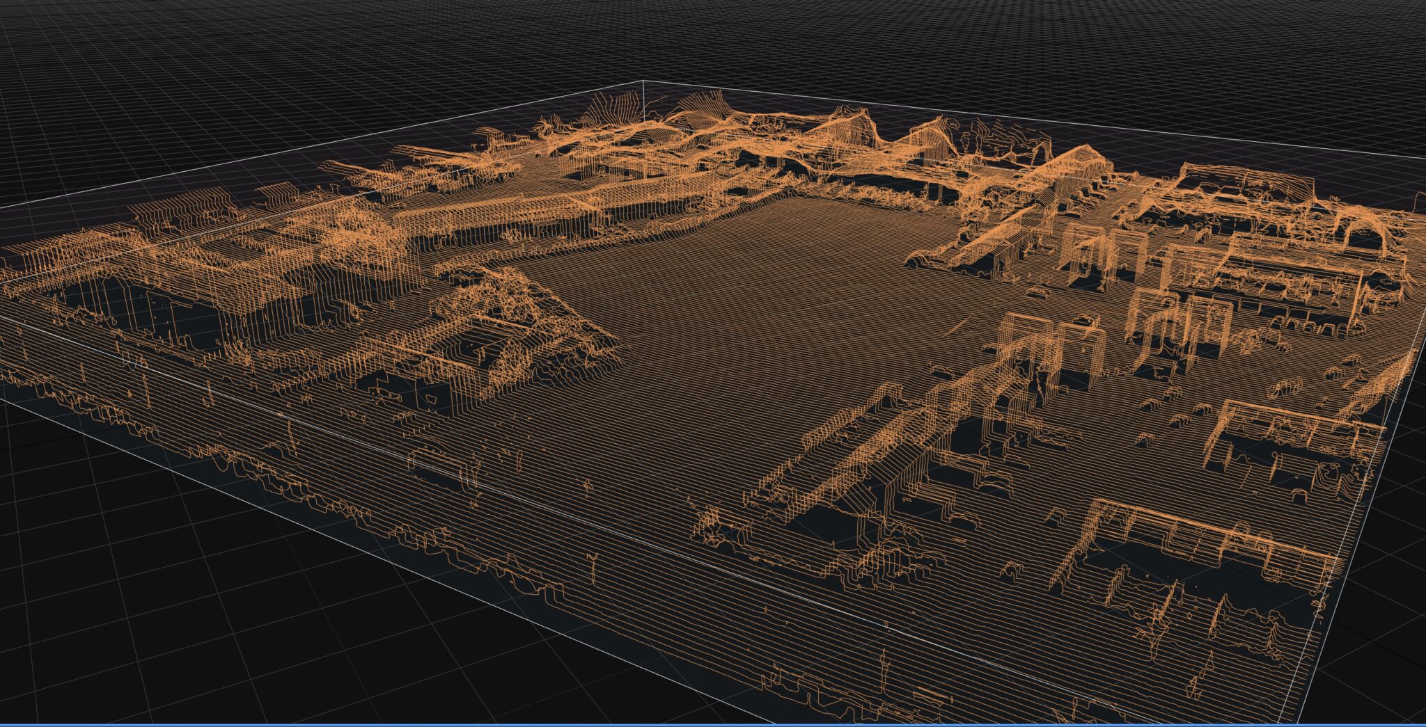
Contour Maps
We generate georeferenced, detailed contour maps that show elevation changes across a site, with data captured at 2cm/px GSD. These maps are used for site grading, drainage design, construction planning, and optimizing land use. Contour maps are vital for projects requiring precise elevation insights, such as landscaping, roadway alignment, and excavation planning.